Queen Charlottes
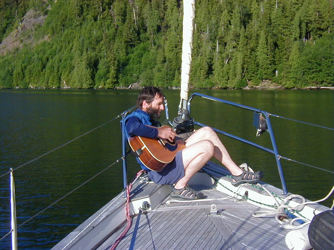
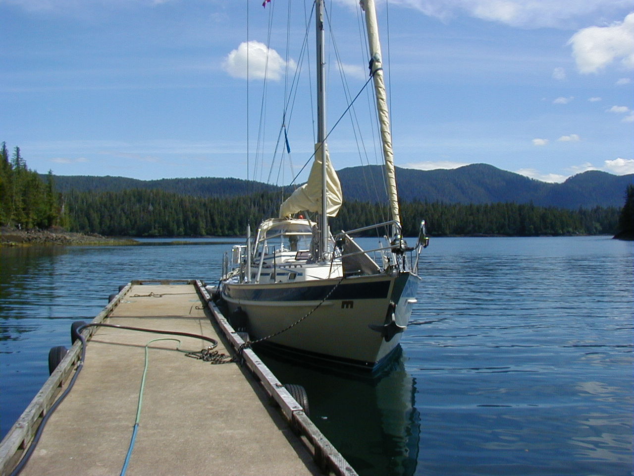
During the summer of 2005, Chris Janowski (aka "CJ") and I took Cats Paw up north for a six week cruise of the Queen Charlotte Islands. Aspiring musicians (CJ on guitar, me on banjo), we called this The Voyage of the Jellyfish Band.
Unfortunately, I wasn't very diligent about sending out logs everyday, so they're pretty spotty.
Voyage of the Jellyfish Band, Day Four
7 June 2005
Lund, BC
49 58.82'N 124 45.82'W
Hello, all!
We are on the move again!
Chris and I spent five days last week in Sidney, getting CATS PAW ready to take her up to the Queen Charlotte Islands. We spent most of our time struggling with the boat's heater. In last year's "April 19" storm off the equator, the boat was repeatedly pooped, and a lot of the water ended up draining through an insert in the lazarette, and onto the heater. When mechanical systems fail, usually there is a single problem, occasionally two. This time, there were four! Every time we thought we had it, another problem would crop up. We ended up having the heater completely apart, right down to disassembling the electric blower motor and cleaning its commutator. After three days, and an overnight package from ScanMarine, we ended up getting it working. Now we're ready for whatever weather the Queen Charlottes throw at us!

On Thursday (2 June), friend Paul Sokol joined us and on Saturday we left for Friday Harbor, in order to check back in to the US. On Sunday, we checked back into Canada, starting the tourist clock running. We spent Sunday night in Ganges, Salt Spring Island.
On Monday, we started north for Nanaimo. The most straightforward way of getting to Nanaimo is through Dodd Narrows, but an 8 knot tidal ebb was predicted for the afternoon, so we had plenty of time to kill, waiting for slack tide. We ended up shutting off the engine a mile short of the Narrows, and drifting in the dead calm air and blue skies. It was absolutely quiet and stunningly beautiful. It was so warm and sunny, I decided I had to go swimming even though the water temperature was only 58F or so. I jumped in the water only to watch CATS PAW glide away from me, still moving from her momentum 5 minutes after shutting off the engine. I swam like mad and managed to catch up to her before CJ and Paul had a chance to restart the engine and go get me.
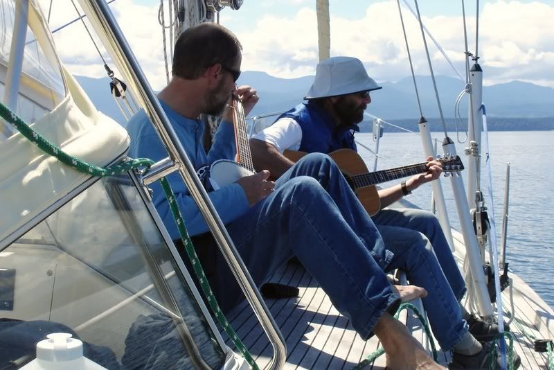
With still at least an hour to waste, CJ and I pulled out guitar and banjo and started serenading the fish. The fish had to suffer, but I'm glad there were no humans within a few miles.
Today we decided we had to make some time, so we had a big day: Nanaimo to Lund, nonstop.
Crew is happy and well. Lots of food on board, lots of good company.
-tk
Voyage of the Jellyfish Band, Day Thirteen
16 June 2005
At anchor, Hague Point Lagoon
52 40.1N 128 51.8W
We are safely anchored in Hague Point Lagoon after yet another long (53nm) day.
But, it was an awesome day. We had planned to do a short, 22nm day to St. Johns Harbour, but the conditions were so good we decided to keep going and round Price Island, through Catala Passage, and up Laredo Sound. This is normally very wild country, but we had light 6-8 knot winds out of the north, so the seas were nearly flat. You could have rowed it. A highlight was going through rarely used Catala Pass, at the southern tip of Price Island. This is a bit of land that hangs south from the BC coast, into Queen Charlotte Sound. It's a very exposed place, so there are only a few trees, and even those are stunted. As we went by the remote McInnes Island Lighthouse, we called them up on the VHF to say hello. The lightkeeper who answered was very friendly and helpful and volunteered a few weather tips.
The anchorage we are in is extremely quiet and bombproof, but involves a shallow (12'), narrow (20') entrance, and an "S" turn to avoid two rocks. We went dead slow (maybe 1kn) with CJ on the bow and had no problem. While I would much rather have her with me, I'm taking advantage of Lee not being on board and taking on the white knuckle moves.
-tk
Voyage of the Jellyfish Band, Day Fourteen
17 June 2005
At anchor, Weinberg Inlet
53 07.5'N 129 31.0'W
Hello, all!
Still another long day, this one into a continuous 15-25 knot headwind. While it was only 43nm, we rarely did over 6 knots due to adverse tides and currents, going up Laredo Channel, separating Princess Royal Island from Aristazabal Island, so it took forever.
Princess Royal Island is the home of the Kermodei, or Spirit Bear, a black bear that is actually colored white or (sometimes) a caramel color. They are a relic of the ice age, when being white was a big evolutionary advantage. Unfortunately, nowadays it's not the advantage it once was, and there are only about 100 of these extraordinary bears left. Lee and I spotted one on our northbound trip in 2002, but Chris and I searched the south shore of Princess Royal in vain and didn't see any. There are proposals to protect the home of the Spirit Bear, but right now that's all they are --- just proposals. See www.savespiritbear.org for more information.
We ended the day in yet another spectacular anchorage, Weinberg Inlet. Great protection and great views. As I write this it is (for this country) hot (78 degrees) and sunny. I even went for a (very brief) swim off the boat. It's been four days since we've had any rain! Remarkable for up here!
-tk
Voyage of the Jellyfish Band, Day Fifteen
18 June 2005
On a mooring ball, Larsen Harbour
53 37.4'N 130 33.1'W
Hello, all!
Our streak of good weather has just been remarkable. Today was yet another sunny, warm day. As I write, it is 6pm in the evening and the outside air temperature is about 70 degrees, with not a cloud in the sky. This is our fifth straight day with such weather --- an unbelievably good streak of luck for these parts. We spend our evenings in the cockpit, drinking gin and tonics, playing banjo and guitar, and enjoying the long, long high-latitude sunsets. Our days have been so long (we got up at 4:30am this morning) that we usually don't even make it to dark before turning in.
Larsen Harbour is the traditional jumping off spot for crossing the legendary Hecate Straits. The Straits are notorious not only because of the (usual) bad weather in these parts, but also because they are unusually shallow for such a large body of water --- for the most part less than 200', often much less. Powerful storms sweep through the area, creating big waves that can become enormous breaking waves when they hit the shallow waters of the Straits. We don't expect anything like that in these benign conditions. Still, CATS PAW will be ready for the worse, everything tied and strapped down, when we leave.
Next log will (hopefully) be from Queen Charlotte City.
-tk
Voyage of the Jellyfish Band, Day Sixteen
19 June 2005
In Sandspit Marina, Queen Charlottes
53 14.29'N 131 51.80'W
Hello, all!
Unfortunately, our long streak of sunny weather with northern winds finally broke last night. For days we've enjoyed the fine weather, albeit at the cost of beating into strong headwinds. Today, we woke up, ready to head southwest across Hecate Strait, to a gray sky and southern winds. Undaunted, we decided to go for it anyway. Besides, it was 4am, we'd had our coffee, and there was no going back biologically.
It turned out to be wet and cold, but a very fine sailing day. The southern winds were more like southeast winds, allowing us to just squeak across in a close reach in the 10-15 knot winds. CATS PAW boomed across the Straits, consistently cranking out 7+ knots, for the 7 hours it took. We were snug in our berth by 3pm.
It was strange sailing across 70 miles of open water, which seldom exceeded 150' in depth. If not for the chop, we could damn near have anchored anywhere along the way. I guess the Caribbean crowd is used to such skinny water (or even much skinnier), but it was a novelty to me. It made for very choppy, unpredictable seas, despite the modest winds.
We're going to hang out here for the next few days, waiting for Lee to arrive.
More later.
-tk
Voyage of the Jellyfish Band, Day Twenty-three
26 June 2005
At anchor, Anna Inlet, Gwaii Haanas Park
52 42.29N 131 50.45W
Hello, all!
After a six day layover in Sandspit, we finally got underway. Actually, the layover, despite its length, was a Good Thing. We met and got to know a number of locals who not only gave us tips about things to see, but also turned out to be very interesting people. First amongst them is Nick Nickolai. We were hitchhiking down to the Skidegate ferry when Nick picked us up in his Suburban. About 70 years old, Nick has lived on the Islands for many years, but also lives in Ketchum, Idaho. As we got to talking, we were all amazed at how many people we knew in common, as well as many parallel passions. In 1978, way before it became fashionable and pre-GPS, Nick sailed a 53' boat to French Polynesia. He's trekked in Bhutan with Charlie Hollister, who I knew at Woods Hole. And so on. We met up again with Nick in Anna Inlet, and again enjoyed an afternoon of listening to stories about the Islands and his many adventures.
Yesterday, on the way south, we stopped at Skedans, a Haida "watchmen" site. These sites are old towns, full of totem poles in various states of decay, which in the past had been vandalized. About 10 years ago the Haida started posting guardians at them to prevent looting. Skedans is one of the larger ones, but has a sketchy anchorage. Fortunately, it was dead calm, so we stopped for about 3 hours and took a tour with one of the guardians. Most of the old houses and poles are barely recognizable because of decay, but some were still striking. The guardian showed us a picture of the village taken in 1898 when nearly everything was standing. Wow! That must have been quite a sigh with those big log lodges and 40' poles out in front. The village was abandoned about 100 years ago because smallpox had decimated the population. The few survivors (about 10 out of 150) moved to Skidegate.
At the end of the day, we anchored in Anna Inlet, a picturesque, calm, beautiful anchorage, surrounded by high peaks and meadows. At least, we thought it was: it was socked in and rained hard all night. This morning, we decided to go for a hike anyway. We put on polypro, rainpants, parkas, and wool hats --- all the paraphernalia every Northwester owns --- and out we went. The woods were wet, muddy, and full of logs and branches to climb over, but we pressed on, following a 50 year old corduroy trail (split logs laid in the ground). Most of the trail had decayed beyond recognition, but enough was left that we were able to track it. After an hour and about a mile, we came to Anna Lake, an incredibly beautiful, dead calm lake with red-throated loons, warblers, dippers, and lots of other birds. By this time, it had stopped raining and the sky was getting lighter. We stayed about two hours, despite the mosquitoes, and drank it all in.
After hiking back down to the boat, we spent the afternoon exploring in the dinghy, looking for the abandoned town of Lockeport. I always enjoy seeing these overgrown, barely recognizable towns, because they are one of the few victories of nature over man. In this case, nature has won decisively. All the wooden houses had long since fallen in and been overgrown by huge cedars and spruces. All that was left was an abandoned 55 Willies with a tree growing out of its grill, and a few stovepipes and machinery parts. Nature triumphs!
Right now, it is streaming sunshine and we are in shorts and t-shirts. You never can figure the weather around here.
-tk
Voyage of the Jellyfish Band, Day Twenty-five
28 June 2005
Murchison Island, Haida Gwaii
52 35.59N 131 28.22W
Yesterday we left beautiful Anna Inlet and headed south. We stopped at "Freshwater Cove," so called because of a small float maintained by the Park Service that has a continuously running freshwater hose. When we got there it was sunny, warm, very calm, and there was no one else around. CJ and I looked at each other, then immediately got our shampoo and soap, took our clothes off, and had an impromptu shower in the icy cold water. Afterwards, we lazed around in the sun, warming back up.
We continued on to Hutton Inlet, a very large inlet on the east shore of Moresby Island, which opens up through a saddle to the west side. Turned out to be a bad choice. Later in the day, the wind started to howl across the island and through the inlet. While safe enough, and protected from chop, it was not a pleasant night. By morning we were surrounded by mist and gloom, while the wind continued to blow through the pass. By noon I had had enough, so we decamped to Murchison Island.
What a difference! Murchison is far enough east that it enjoys a bit of a rain shadow from the mountains of Moresby Island. Plus, it is a more protected anchorage. While not sunny, it's not raining and much calmer.
While strolling along the beaches of Murchison this afternoon, both Chris and I were struck by how little wildlife we have seen, particularly bird life. Apparently, we are not imagining it. Introduced species, particularly Black and Norwegian rats, have decimated the local bird colonies down to a fraction of their former size, 6% by one estimate. Particularly hard hit have been the many burrowing species, such as Ancient Murrelets (of which we have yet to see one in this area).
Makes for very quiet, reflective strolls...
-tk
Voyage of the Jellyfish Band, Day Twenty-six
29 June 2005
Ramsay Island Cove
52 34.38N 131 23.81W
Hello, all!
A map we have shows an abandoned Haida village on the south side of Murchison Island, so feeling up for a walk anyway, we decided to see if we could find it. Four hours and maybe two miles later, we stumbled back to the boat, beat. The vegetation is so thick, so dense, and so BIG around here, that it's slow going to get anywhere. If there was ever a village, it was quickly reclaimed by the temperate jungle that is Haida Gwaii.
We moved over to Ramsay Island Cove later in the day in order to be closer to the Gandl K'in Gwaayaay hotsprings. From here, they are about a mile and a half ride in the dinghy across open water. It was pretty calm this afternoon, so we had no problem zipping over there.
What a place! The Haida have an eye for architecture and space. The hotsprings are actually a series of pools, built right into the natural rocks with maybe a bit of mortared rock here and there to keep the water in. Most are fed by natural seeps, a couple with a pipe. Besides the Haida watchman and his family, Chris and I were the only people around, so we took our time sampling all the different pools and enjoying the killer views across Juan Perez Sound.
When we were finished, we went into the watchman hut to meet Al, his wife Gladys, and grandchild Josh. Gladys is a master weaver who usually works with cedar but, as an added challenge, has recently taken on pine needle weaving. She showed me a bundle of Ponderosa Pine needles that she had just bought for $6! We told her that our back yards were littered with the stuff and promised to send her a package when we got back.
All-in-all, it was an unforgettable afternoon in a beautiful spot.
-tk
Voyage of the Jellyfish Band, Day Thirty-five
8 July 2005
Still at Rose Harbour
52 09.02N 131 05.18W
It was seven days ago that we first pulled into Rose Harbour, at the very southern tip of the Queen Charlottes. Since then, we have been sitting on the boat waiting for a weather window to do the passage back to Vancouver Island, as low after low has barreled through the area. This is also our seventh straight day of pouring rain, the remarkable sunny weather of the first half of the trip a distant memory.
I think Rose Harbour is some kind of purgatory, as if there is some personal salvation that must be achieved before the weather gods will let us move on to the next stage of our lives. CJ says it's learning to play the banjo. If that's the case, with all this time on my hands, I have been making a lot of progress, so perhaps release is near. The long range forecast (96 hour) looks encouraging, hinting at a return of the North Pacific High, the normal state of affairs for this time of year, and more favorable northern winds.
In the meantime, the time has not been a total waste. Besides working on the banjo, we enjoyed a visit to SGang Gwaay (anchorage), an abandoned Haida village with the best collection of standing totems in the world. It is an eerie and inspiring place. Guided by Breezy, a resident 11 year old girl, CJ and I took turns walking through the village imagining what it must have been like during its prime, while the other stayed on the boat, watching for wind shifts.
We have also spent a lot of time on shore and out and about, always in full rain gear, much of it with Susan, a sturdy Rose Harbour resident. In her tiny, wood-fired kitchen, Susan turns out delicious meal after meal for whomever might wander by. Yesterday, we took a drenching dinghy ride over to Rose Inlet to check her crab pot, finding four big male crabs, dinner for last night.
... and so we continue to wait.
-tk
Epilogue
Yes, we finally did get out of Rose Harbour! On 10 July, after 8 days of deep lows blasting over the Queen Charlottes, we finally got a weather window and headed across Queen Charlotte Sound in the company of S/V Magic, a Hallberg-Rassy 42 owned by Len and Katy Friedel. We headed for Sointula, on Malcolm Island, always one of our favorite spots, because we weren't quite ready for the commotion of the "big city" of Port McNeill.
The next day we went over to Vancouver Island and Port McNeill where CJ flew home, to be exchanged for friend Chet. We then sailed the boat down to Seattle over the next week.